



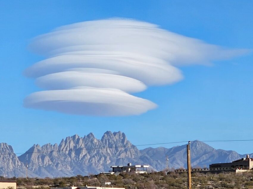
Our Weather Watchers were out in force this weekend, capturing pictures of very rare Lenticular Clouds. These “space ship” looking, disc-shaped clouds look pleasant and peaceful, but they’re actually quite violent inside. They form as fairly humid air is lifted up by a mountain or some other orographic feature, such as tall buildings. The air cools rapidly, forming a cloud. The wave affect in the wind flowing over the mountain causes a circular rotation. You’re forecast is below…
Lenticular Cloud by Weather Watcher Rebecca Rocha
TONIGHT: The skies will be mostly clear, but the winds will shift NE-east with the edge of a cold front. The NE-E winds will range from 10-25 mph with stronger gusts on the west slopes of the mountains. The low will drop to a very cold 26.
FORECAST: Tuesday will be a sunny but colder day with a high of 54. The day will start out very cold, but by afternoon, the winds will turn light and variable at 5-15 mph. Wednesday will be partly cloudy and warmer with a high of 64. The SW winds will range from 10-20 mph. Thursday will be sunny and gorgeous with warm breezes and a high of 69. Friday will be partly to mostly cloudy and cooler with a high of 57. Saturday will be partly to mostly cloudy with a high of 54. Sunday will be partly to mostly cloudy with a high of 58. Monday will be cloudy with a little light rain here and there and a high of 57.
Read: Read More