


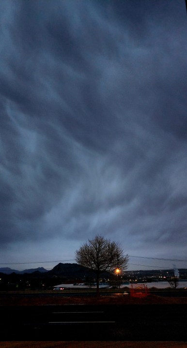
What a weather day! Our peak gust has been 44 mph at the airport with stronger gusts right on the eastern slopes of the mountain. Rain totaled 0.01 inches in the official rain gauge. We’ve seen dark clouds, sunny skies, and a dusty haze. Many thanks to Weather Watcher Brigitte Lewis for capturing this ominous image of heavy rain clouds over West El Paso and New Mexico.
TONIGHT: A Wind Advisory is posted until 8 PM. The SW winds will range from 15-50 mph with the strongest gusts on the east slopes. The skies will be partly to mostly cloudy with isolated showers. Expect the skies to clear early in the morning as the winds slowly die down. The low will be 36.
FORECAST: Thursday will be much, much nicer with mostly sunny skies and lighter winds. With a high of 59, the SW winds will range from 10-25 mph and may feel chilly at times. Friday will be partly cloudy and 58 with light SW breezes. Saturday will be mostly cloudy and windy as a cold front pushes in. Saturday’s high will be 51*, but the coldest winds will hit in the afternoon and evening. Expect scattered rain showers to mix over to light snow flurries Saturday night. No accumulations are expected. Super Sunday will be cold, partly cloudy day with a high of 48. Sunday’s west winds will gust to near 40 mph and will feel very, very cold. We’ll have the slightest chance of a few flakes (nothing more) on Sunday. Monday will be sunny and 58. Tuesday will be sunny and 64.
Read: Read More