


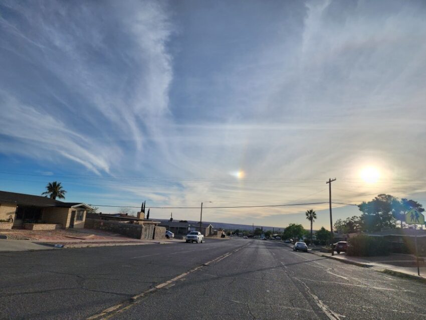
Weather Watcher Rick Smith submitted this fantastic picture. If you look very closely, you can see a rainbow like ring around the setting sun. The sun’s rays are passing through cirrus ice crystals, and it is refracting the light into a slight rainbow. Cool, Rick, thank you!
TONIGHT: The skies will be clear overnight, and the NW winds will slowly die down to near calm by morning. Until then, the NW winds will range from 10-25 mph with those stronger gusts on the east slopes of the mountains. The low will drop to 57.
FORECAST: High pressure really builds up quickly for Thursday. Thursday will be sunny with warm breezes and a high of 92. The SW winds will range from 10-25 mph (no dust). On Friday, look for mostly sunny skies, a few clouds, and a high of 90. The SW winds will range from 10-25 mph. On Saturday, the winds turn east with stronger gusts on the west slopes. The high will drop to 79, and the skies will turn partly to mostly cloudy. Far east El Paso County has a slight chance of isolated t-storms. Sunday will be partly cloudy with light winds and a high of 82. Monday will be partly to mostly cloudy with a high of 87.
Read: Read More