


What an absolutely beautiful day with various clouds, scattered showers, and even isolated t-showers. The best part… the high was 93. The surge of tropical moisture was a mixed blessing for firefighters in Ruidoso. Ruidoso was under a Flash Flood Warning much of the day. The forest needs the rain, but firefighters don’t need flooded streams and roads. Either way, the tropical moisture thins out for the weekend as temperatures soar again.
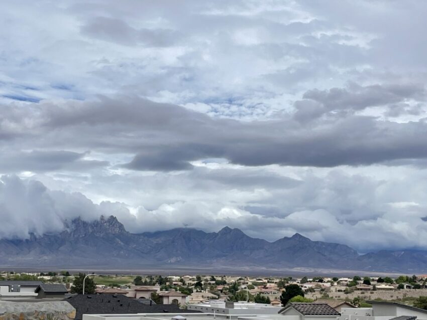
Weather Watcher Amruta Chaitanya sent this incredible picture of the low-hanging clouds over the Organ Mountains in Las Cruces.
TONIGHT: The skies will be partly to mostly cloudy early evening with isolated area t-showers. The atmosphere is still very unstable with plenty of tropical moisture; therefore, any storms that may arise have the potential for brief, heavy rainfall. Late evening, the skies will become partly cloudy, and the chance of rain will pass. The SE winds will range from 10-20 mph, and the low will drop to 73.
FORECAST: Saturday will start out with mostly cloudy skies but turn mostly sunny and hot by afternoon. Surface dew point temperatures will still be elevated, so it will feel both hot and a little humid. Saturday’s high will be 100, and the SE winds will range from 10-20 mph. Sunday will be mostly sunny and even hotter with a high of 104. The SE winds will range from 5-15 mph. High pressure builds up for the workweek ahead. Monday will be partly cloudy and 105 with a slight chance of isolated area storms. Tuesday will be partly cloudy with a slight chance of isolated storms and a high of 106. Wednesday should be the hottest day as high pressure reaches its maximum. Wednesday will be partly cloudy with a high of 107. This could unleash some potentially powerful storms by Wednesday evening. Thursday will be partly to mostly cloudy with scattered showers and t-showers. Thursday’s high: 99.
Read: Read More