


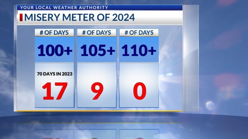
We added to the “Misery Meter” today. Today’s high was 105, and that brings our total of triple-digit days to 17. Nine of those days were 105 or hotter. The record on this day is 111 set in 1978.
Are you ready for monsoon storms? Remember, there is no guarantee that you will receive a direct t-storm every day, but we’ll have a CHANCE of t-showers each day for the next 9 days.
TONIGHT: The skies will be partly cloudy early in the evening but turn clear overnight. The SE winds will range from 5-10 mph, and the low will drop to 80.
FORECAST: A Heat Advisory is posted through Wednesday. Tuesday will be partly cloudy and very hot with a high of 107. The variable wind will range from 5-15 mph, and the general humidity will climb. Expect widely scattered late day t-storms. Wednesday will be partly cloudy with a high of 105. Expect widely scattered showers and t-storms late Wednesday, and some of those storms may reach severe limits. Thursday will be partly to mostly cloudy with a high of 101. Isolated area t-showers will be likely. Friday will be partly cloudy and 103. Isolated late storms will be possible. Saturday will be partly cloudy and 101 with widely scattered late day t-showers.
Read: Read More