


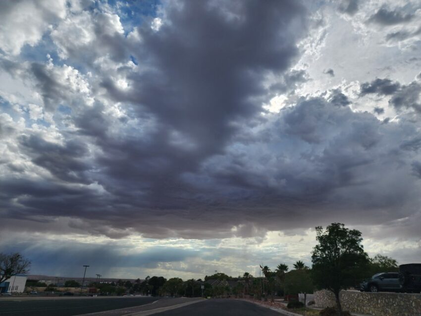
The clouds and moisture kept us under 100 today with a high of 98. The record high today is 113 set in 1994. As for rain, many parts of El Paso saw flooded streets yesterday, while not a single drop fell in the official rain gauge at the airport. We’ve only received 0.88 inches at the airport so far this year. Weather Watcher Rick Smith captured this dramatic image yesterday in West El Paso.
Even though there was a Flash Flood Warning very close to my home, the Upper Valley did not get but a few drops where I live. I felt like these “rain watchers” sent in by Virginia Ann, who said her sister’s dog Oreo and cat Orochi enjoyed watching the rain. We have a chance of more t-showers this evening.
TONIGHT: The skies will be partly cloudy with scattered evening t-showers. Individual storms may produce brief, heavy rainfall. The west-NW winds will range from 5-10 mph, and the low will drop to 78. Storms and skies will clear late evening.
FORECAST: A Heat Advisory is in effect starting Friday at noon through Saturday. Friday will be partly cloudy and 103 with isolated area t-storms. The chance of rain will go down on Friday as moisture begins to thin out a bit. The west winds will range from 5-15 mph. Saturday will be partly cloudy and hotter with a high of 105. Widely scattered showers and t-showers are likely Saturday evening. Sunday will be partly cloudy and hot with a high of 106. We’ll have only a slight chance of isolated area storms. Monday will be partly cloudy and dry with a high of 104. Tuesday will be partly cloudy with a high of 103. Expect isolated area storms with a low rain chance on Tuesday evening. Wednesday will be partly cloudy and 103 with widely scattered t-showers.
Read: Read More