


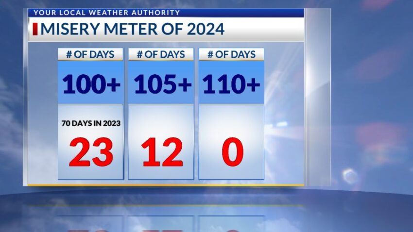
I have bad news. Remember how last year was a record year for triple-digit days, 70 in total? Well, this year we are 5 triple-digit days AHEAD of last year with a total of 23 so far this year. (Last year, we had 18 at this point.)
TONIGHT: The skies will be partly cloudy with isolated t-showers. Brief, heavy rainfall will be likely with some area storms, and some storms may develop late into the night. Overnight, the skies will be partly cloudy, and the low will drop to 78. The variable winds will range from 5-10 mph excluding possible gusts near storms.
FORECAST: Wednesday will be partly cloudy with a high of 100. The atmosphere is very unstable, so the t-showers that develop on Wednesday afternoon could produce brief, heavy rainfall. Thursday, the Fourth of July, will be partly cloudy with a few late day storms. Overall rain chances go down a bit on Thursday, and the high will be 102. Friday will be partly cloudy with a high of 100. Expect widely scattered and potentially strong t-showers on Friday. Saturday will be partly to mostly cloudy with a high of 99 with isolated late day t-storms. Sunday will be mostly sunny, hot, and dry with a high of 104. Monday will be partly cloudy and 103 with isolated late day t-storms.
Read: Read More