


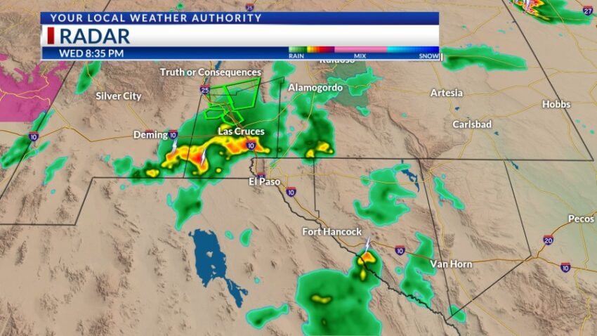
Much like last night, two clusters of strong t-showers are approaching El Paso from the north. These storms are likely to cause a significant gust front and stir up the dust. Storms have the potential to become severe and unlock heavy rainfall. Do not drive into flooded roadways.
TONIGHT: KTSM has issued a Weather Authority Alert due to the potential for strong storms and brief, heavy rainfall. The skies will be partly cloudy with widely scattered showers and t-showers. Some storms may become strong and produce brief, heavy rainfall. Storms will slowly taper off before midnight. The low will drop to 72, and the SE winds will range from 5-15 mph with occasional gusts. Some gusts may become quite strong.
FORECAST: Thursday will be partly cloudy and hot with a high of 99. We’ll have a much lower chance of isolated late day t-storms in the area, and the chance for any heavy rainfall drops substantially. The SE winds will range from 5-15 mph. Friday will be hot and dry with a high of 100. The SE winds will range from 5-15 mph. Saturday will be an extremely hot day with a high of 104. Expect lots of sunshine and hot breezes, and we should be storm free. Sunday will be partly cloudy with a high of 102. Monday will be partly cloudy and 97 with scattered late day t-showers. Tuesday will be partly to mostly cloudy and 94 with widely scattered showers and t-showers.
Read: Read More