


The cold front arrived bringing gusts this morning of 32 mph. The official high was 55*, but that was a midnight high temperature. The closest we’ve come to freezing was 33 at the airport on November 11, but tonight will be much colder.
TONIGHT: KTSM has issued a Weather Authority Alert due to our first official freeze of the season, which will also be a hard freeze. Please make preparations now to protect people, pets, pipes, and plants as the low drops to 25 at the airport, 21 in the valley. The skies will be clear, and the winds will be light out of the north at calm to 10 mph.
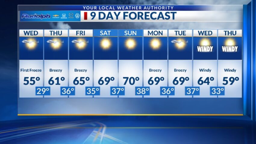
FORECAST: Wednesday will start out freezing and clear but warm up to 55 in the afternoon. Sunshine will start the day with partly cloudy skies to end it. Winds will be light and variable at 5-10 mph. Thursday will be mostly sunny, a bit warmer, and breezy with a high of 61. Friday will be mostly sunny to partly cloudy with a high of 65. The SW winds will range from 10-25 mph. Saturday will be sunny and warmer as high pressure builds up. Saturday’s high: 69. Saturday will be sunny and breezy with a high of 70. Monday will be sunny and breezy with a high of 69. Tuesday will be windy at times with a high of 68 and partly cloudy skies.
Read: Read More