


The low at the airport this morning was 26, an improvement over yesterday’s 16. Here are the other low temperatures from throughout the Borderland.

We had a deck of cloud cover come in last night that kept the temperatures about 6-10 degrees warmer. That will not be the case tonight as we get colder again.

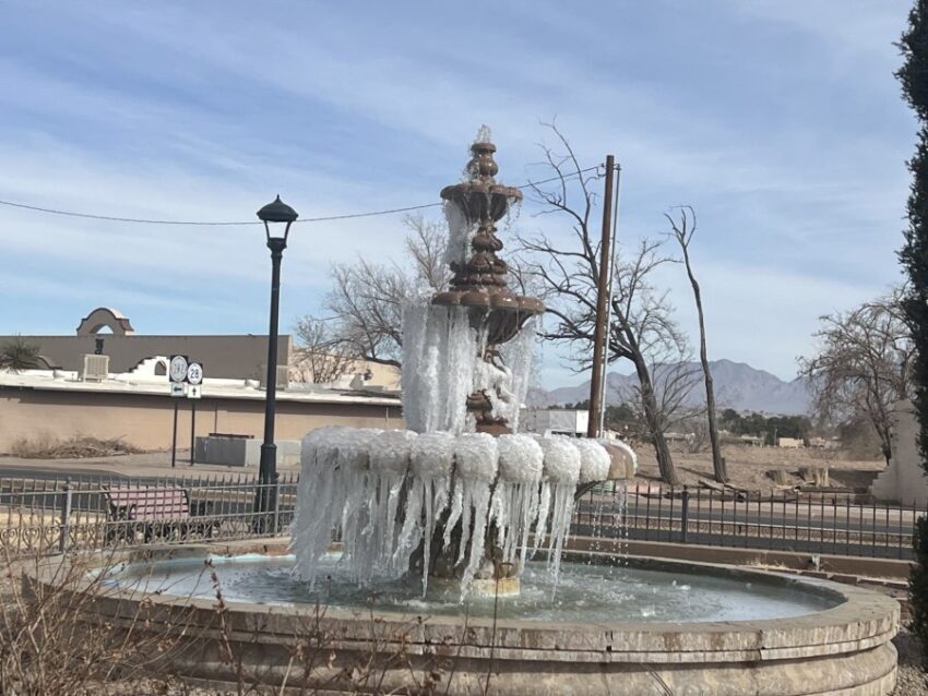
We’re in for one more exceptionally cold night before the fountain has a chance to melt. Here’s your 9-Hour Forecast for Friday.

TONIGHT: Another cold front pushes in overnight tonight. The north winds will range from 10-30 mph, ushering in some cold air. The winds will die down overnight, and the low will drop to 18 at the airport, 13 in the valley.
FORECAST: Friday will be clear and very cold in the morning. By afternoon, we will start to warm up nicely. The SW breezes will range from 5-15 mph, and the high will climb to 54. Friday will truly be “perfection achieved.” Saturday will be partly cloudy and windy. Saturday’s high: 64. The SW winds will range from 10-20 mph. Sunday will be partly cloudy and warmer with slightly stronger winds. The SW winds will range from 10-30 mph with only a slight chance of a dusty haze. Sunday’s high: 67. Monday will be partly cloudy with similar winds to Sunday. With a high of 68, expect a slight dusty haze by afternoon. Tuesday will be partly cloudy and 60 with moderate winds. The clouds thicken on Wednesday as the high drops to 50. Thursday will be cloudy with a few drops of rain and a high of 45. On Friday, skies clear up for a sunny afternoon with a high of 49.

Read: Read More