


The high was 55 today, and the peak gust was 33 mph. Tomorrow, the winds get stronger, gusting to near 45 mph east of the mountains. Yes, the winds will feel quite chilly at times, so grab a jacket. Here’s your exclusive 9-Hour Forecast with your detailed (and very warm) 9-Day Forecast below.

TONIGHT: The skies will be partly cloudy, and the winds will be gusty and chilly overnight. The west winds will gust to near 40 mph, with those strongest gusts on the east slopes of the mountains. The low will drop to 31 as the winds die down slightly overnight.
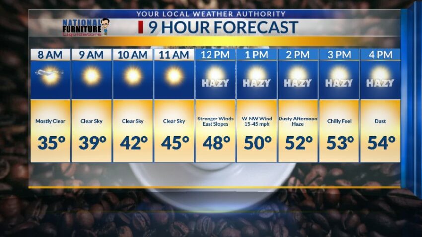
FORECAST: KTSM has issued a Weather Authority Alert for gusty winds and a dusty haze on Thursday. Thursday will bring much stronger winds than those on Wednesday. The west-NW winds will range from 15-45 mph. With a high of 54, those gusty winds will feel pretty chilly at times. Skies will be sunny with a dusty haze possible by late afternoon. Thursday night, the winds will die down leaving us clear and cold with a low of 28. Friday will be sunny with light winds and a high of 65. Saturday will be mostly sunny with a few clouds and a high of 70. Sunday will be mostly sunny and 76. The winds on Sunday afternoon will gust to near 25 mph. High pressure ensures a very warm workweek with possible record temperatures. Monday will be sunny and 78. Tuesday will be sunny and 76.

Read: Read More