


It’s been quite a dusty Valentine’s Day. The peak gust has been 44 mph, and the high climbed to 74. Unfortunately, the worst may be yet to come as a powerful low-pressure system sweeps over the Borderland overnight/early morning Saturday. Here’s your exclusive 9-Hour Forecast for Saturday.

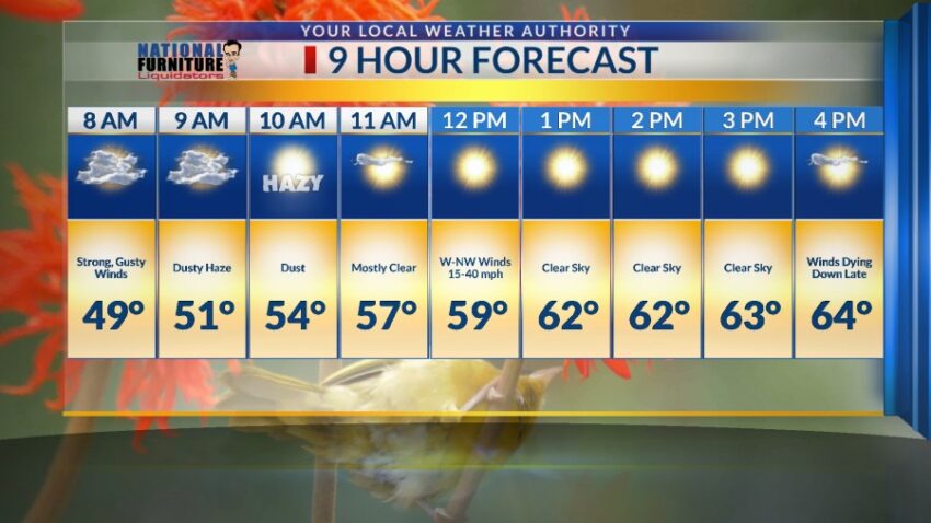
TONIGHT: KTSM has issued a Weather Authority Alert due to the strong winds and blowing dust that will affect the Borderland overnight and into Saturday morning. The skies will be partly cloudy, and the winds will be very gusty. The west winds will gust to near 55 mph, with some of the strongest gusts on the east slopes of the mountains. Blowing dust will be a factor all night. Some of the strongest winds could hit between midnight and 6 AM. The low will be 49.
FORECAST: Saturday will be partly cloudy with gusty winds and a dusty haze. The winds turn cooler with gusts near 45 mph. Saturday’s high: 64. The strongest winds will be early Saturday morning and will slowly diminish through the day, calming down completely Saturday night. Sunday will be beautiful with some high clouds, light winds, and a high of 69. Monday will be mostly sunny and warmer with a high of 75. The SW winds will pick up and gust to 35 mph. Tuesday will be partly cloudy and 71. The afternoon winds will become gusty with a slight dusty haze. Wednesday will bring gusty winds to the west side with a mild cool front. Wednesday’s high: 66. Thursday will be partly cloudy with cooler winds and a high of 59. Friday will be mostly sunny and 61 after a chilly morning.

Read: Read More