


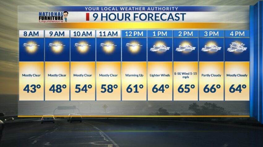
What a chilly change today! After so many warm, mild days, today’s official high was only 58, which is 7 degrees below normal. The peak gust today was 23 mph, which made for a very chilly day at times. We are in for one more night below freezing with a low of 30 before we warm up nicely for the week’s end. Here’s your exclusive 9-Hour Forecast for Friday.

TONIGHT: The skies will be partly cloudy, and the winds will settle down to a light, cold breeze out of the E-SE at 5-15 mph. The low will drop to 30 at the airport, 27 in the valley.
FORECAST: Friday will be partly cloudy with warmer breezes and a high of 66. The E-SE winds will range from 5-15 mph. Saturday will be sunny and windy at times with a high of 68. The W-NW winds will range from 5-25 mph. Sunday will be sunny and breezy as we warm up to 73. The NW winds will range from 5-20 mph. Monday will be sunny and 80 as high pressure builds up in a dramatic way. Tuesday will be mostly sunny and 83, our warmest day of the week as high pressure reaches its maximum. Wednesday will be partly cloudy with a high of 80. The winds will become gusty late Wednesday in advance of a cold front on Thursday. Thursday will be partly to mostly cloudy and windy on the west slopes of the mountains. Thursday’s high: 68. Another ridge of high pressure starts to form on Friday raising the high of 78.

Read: Read More