


Another horrible weather day!! Technically, today was worse than yesterday because the peak gust was stronger: 59 mph at around 7 AM. We knew that a cold front would lower today’s temperatures. The official high was 65. The record is 84 set in 1908 and 2009. Are you ready for a break from the strong winds and dust? (Silly question.) Here’s your exclusive 9-Hour Forecast for Wednesday:

TONIGHT: The skies will be hazy due to blowing dust early in the evening. The NW winds will range from 15-50 mph. Slowly through the evening, those strong winds will diminish. Past midnight, the winds will die down to a very light breeze. The low will drop to 39.
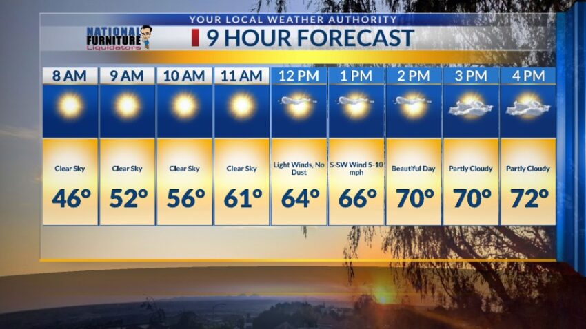
FORECAST: Wednesday will be beautiful with partly cloudy skies and light winds, a refreshing reprieve from the strong winds. The south breeze will range from 5-10 mph, and the high will be 72. Thursday will bring more gusty winds and a dusty haze. The SW winds will gust near 50 mph, and the high will be 78. Friday will be partly cloudy with strong winds and blowing dust. The west-NW winds will gust near 60 mph. Friday’s high: 66. Saturday will be a terrible weather day with strong winds and a chance for a few drops of rain, creating “mudballs” on the cars. The west-NW winds will gust near 60 mph. A cold front pushes through, dropping Saturday’s high to 59. Sunday will be a beautiful day with a high of 68. The winds will be light and variable. Monday will be sunny and warmer with a high of 79.

Read: Read More