


EL PASO, Texas (KTSM) — Happy Monday, El Paso. Hopefully, you enjoyed the dust-free weekend and start to the workweek because beginning Tuesday the Borderland area is going to see a stretch of windy days.
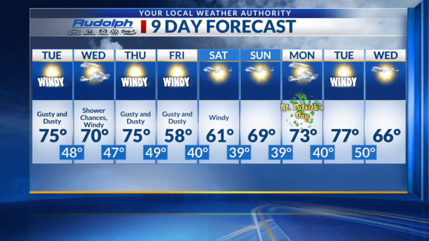
Tuesday will have a high near 70 and start off mostly sunny. Those conditions will quickly change by the afternoon when southwest winds will blow 20-25 mph with gusts near 30 mph. While these winds are not near advisory levels, they will still blow dust, creating concerns for visibility. The low going into Wednesday morning will be 48.
Unlike last week, this Wednesday will not be a buffer day between windy days. Wind speeds and gusts will be very similar to Tuesday with a high in the lower 70s. The chance for rain showers earlier in the day is the reason why blowing dust is a slight possibility. We’ll see a low near 47.
Come Thursday, gusty and dusty conditions return with stronger winds back in the picture. A high near 75 is expected with a low around 49. For Friday strong winds will still be present, but temperatures will be much cooler with a high in the upper 50s is expected with a low near 40.
Winds continue for Saturday, but like Wednesday blowing dust will depend on how long moisture from the Pacific storm systems stick around. A high in the lower 60s will be present with a low in the upper 30s. A gradual warm-up trend starts Sunday through Tuesday where we inch closer to an 80-degree high. Another windy Tuesday is back on the board, before a slight temperature drop on Wednesday.
 Read: Read More