


EL PASO, Texas (KTSM) — Multiple hazardous weather conditions are threatening the region starting Thursday night through Friday morning.
The National Weather Service has issued a high wind warning, red flag warning, and blowing dust advisory for parts of El Paso and much of the Borderland region.
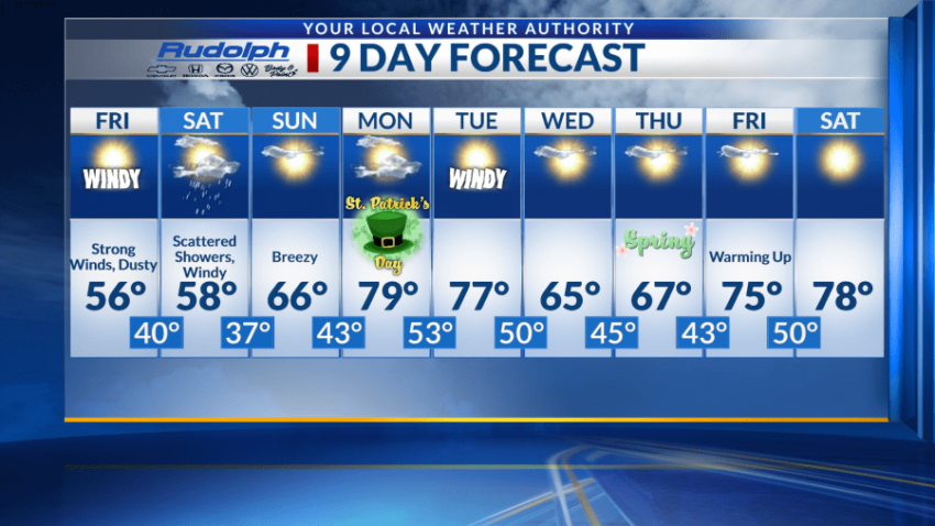
Starting tonight, we’ll see areas of blowing dust with winds increasing to 45 to 55 mph, with gusts potentially reaching speeds of 75 mph near the east slopes of the Franklin mountains. Scattered showers are likely after midnight where we will see a low near 40 and broken cloud coverage.
For Friday these high winds continue, blowing from the west at speeds of 45-55 mph and eventually decreasing to 30-40 mph by the afternoon. Blowing dust is still a threat, potentially reducing visibility in some areas. We’ll see a high near 56 and a low around 40. Overnight, isolated showers are once again present with partly cloudy skies. Wind gusts will be as high as 41 mph.
Shower chances still stand for Saturday, along with windy conditions and blowing dust. Winds will be 25-30 mph, with gusts near 40 mph. A high near 58 and a low near 38 are expected.
Sunday brings breezy conditions and mostly sunny skies. Expect a high near 66 and a low near 43.
The next workweek is not as active, with Monday beginning very warm, the high near 80, and a low near 53.
Winds return Tuesday with a high near 80 again and a low around 50. Wednesday and Thursday will be cooler, with highs in the mid-60s and lows in the 40s. Temperatures will warm up again for Friday and Saturday, with highs in the upper 70s.
 Read: Read More