


It was a record weekend with highs of 96 on Saturday (old record 90 in 1982, 2017, 2018) and 93 on Sunday (old record 92 in 1995). Today, thankfully, we dropped below 90. We are in for a terrible end of the week. Of particular concern is Good Friday, when many make the pilgrimage up Mt. Cristo Rey. We could see a total brown out from dust on Friday afternoon. Here’s your exclusive 9-Hour Forecast for Tuesday:

TONIGHT: The skies will be partly to mostly cloudy. The winds will be light and variable at 5-10 mph. The low will be a mild 60.
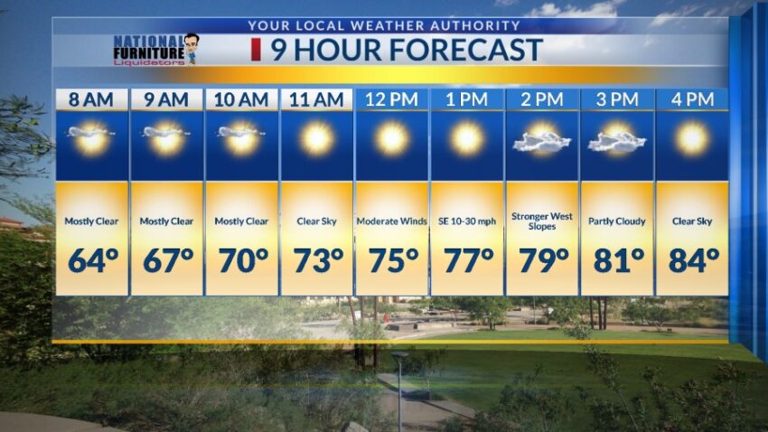
FORECAST: Tuesday will be partly cloudy and slightly cooler with a high of 84. The winds shift SE at 10-30 mph with stronger gusts on the west slopes. Wednesday will be sunny and windy with a high of 91. The SW winds will pick up and gust near 35 mph, which will cause a slight dusty haze by late afternoon. Thursday will be a terrible weather day with strong winds and blowing dust. With a high of 90, the west winds will gust near 60 mph, producing a brown-out of dust in the afternoon. Good Friday will be a terrible weather day, especially in the afternoon when the winds are strongest. With a high of 83, the west winds will gust near 60 mph, producing a brown-out of dusty by afternoon. Saturday will be gusty and cooler with a high of 75. The west-NW winds will gust near 50 mph, which will produce blowing dust. The good news is that Easter Sunday will be sunny and beautiful with a high of 78.

Read: Read More