



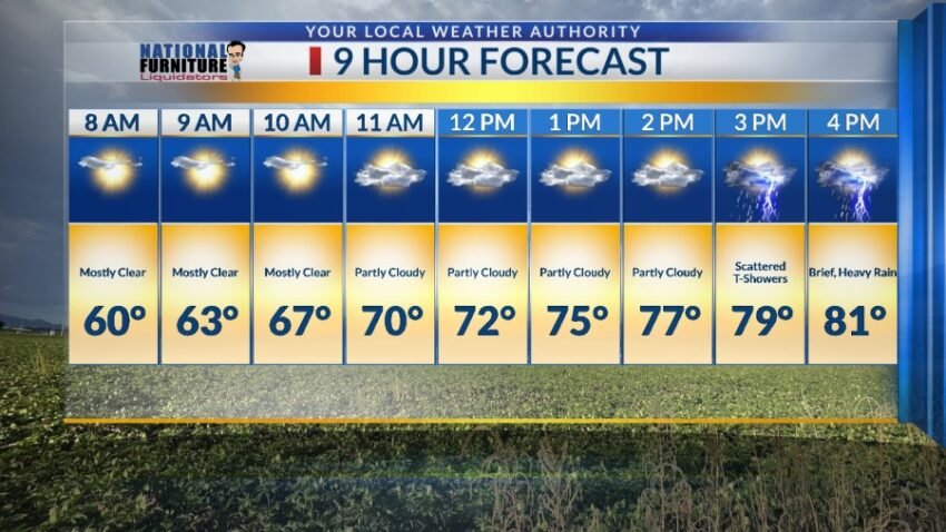
We are experiencing something we have not felt in a while: elevated humidity. That elevated humidity increases on Saturday, giving us an increased chance of scattered t-showers. Some individual storms may produce brief, locally heavy rainfall. Here’s your exclusive 9-Hour Forecast for Saturday:

TONIGHT: You can certainly feel the elevated humidity with dew points in the upper 30s and low 40s. Look for partly to mostly cloudy skies with isolated area t-storms. The SE winds will range from 10-25 mph with stronger gusts on the west slopes of the mountains. The low will drop to 57.
FORECAST: KTSM has issued a Weather Authority Alert due to scattered t-showers with brief, heavy rain on Saturday and gusty winds and a dusty haze on Sunday. Saturday will be partly cloudy with scattered area t-showers. Some individual storms may produce brief, locally heavy rainfall. The SE winds will range from 10-25 mph, and the high will be 81. Sunday will start out sunny and beautiful, but by the afternoon, the winds will become quite gusty. The SW winds will peak near 50 mph, which is likely to cause a dusty haze by late in the afternoon. Sunday’s high: 89. Monday will be partly cloudy and gusty with a dusty haze in the afternoon. Monday’s high: 80. Tuesday will be partly cloudy and 78 with lighter, cooler winds. Wednesday will be sunny and beautiful with a high of 81. Thursday will be partly cloudy with a slight chance of isolated area t-storms. Thursday’s high: 85.

Read: Read More