



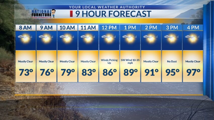
Wednesday may be the last day in the 90s for a while. The moderate winds will gust near 35 mph (no dust) and will pop the high up to 97. We face dangerous heat this weekend. Here’s your exclusive 9-Day Forecast for Wednesday:

Weather Watchers Ray and Dee Compary sent this picture of the water finally flowing down the Rio Grande.

TONIGHT: The skies will be mostly clear with just a few clouds early in the evening. The west winds will range from 10-25 mph, a bit breezy on the east slopes of the mountains. Through the night, the skies will turn clear, and the winds will become calm. The low will be 70.
FORECAST: Wednesday will be mostly sunny with a few clouds and a high of 97. The SW winds will pick up by afternoon and gust near 35 mph with the strongest gusts on the east slopes of the mountains. We will not see dust from these moderate winds, but they will raise our high temperature. Thursday will be sunny and hot with a high of 100. Friday will be sunny and hotter with a high of 102. High pressure settles in for the weekend and will take temperatures into the extreme range. Saturday will be sunny with an extremely hot high of 105. Sunday should be the hottest day of the week with a high of 107. Sunday will be sunny with hot breezes. Monday will be mostly sunny with a high of 101. Tuesday will be partly cloudy and 100.

Read: Read More