


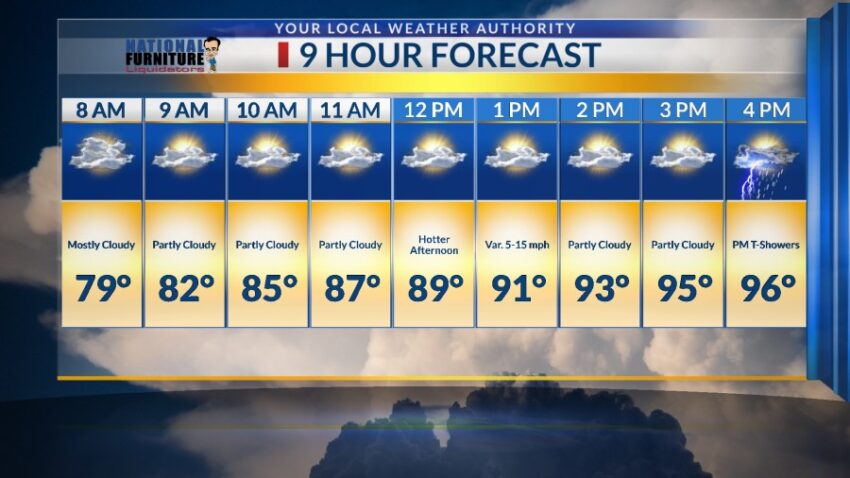
Get ready to heat up! Here’s your exclusive 9-Hour Forecast for Saturday:

TONIGHT: The skies will be partly cloudy with isolated showers and t-showers this evening. Some individual storms may produce brief, heavy rainfall. Late evening, the t-showers will taper off leaving slowly clearing skies. The low will drop to 69, and SE winds will range from 5-15 mph. Occasional gusts will be likely as area storms break apart.
FORECAST: Saturday will be partly cloudy and 96 with scattered late day t-showers. The variable winds will range from 5-15 mph, and the afternoon will feel quite hot and muggy. Sunday will be partly cloudy and 99 with scattered late day showers and t-showers. With a high of 99, this could enhance the strength of some of the t-showers, causing heavy rain and even small hail. Monday will be partly cloudy and 98. Once again, we’ll see scattered late day t-showers that could become strong. Tuesday will be partly to mostly cloudy and 92 with scattered t-showers. Wednesday will be partly cloudy and 96 with isolated late day t-storms. Rain chances go down on Wednesday. Thursday will be partly cloudy with scattered t-showers. Thursday’s high: 87.

Read: Read More