


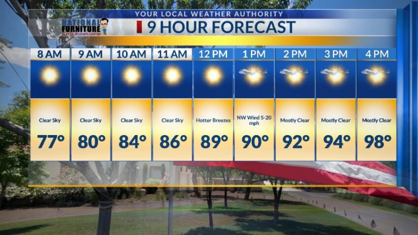
I have dropped the Weather Authority Alert because the threat of heavy rainfall has passed. Now, we shift gears and focus on the heat. Unfortunately, it’s time to fire up the “Misery Meter” again starting Saturday. Here’s your exclusive 9-Hour Forecast for the 4th of July:


TONIGHT: The skies will be partly cloudy with a slight chance of a hit-or-miss t-shower during the evening hours. Individual storms may produce brief, heavy rain, but storms should be passing quickly, which will reduce the chance for flooding. Overnight, the skies will clear up, and the low will drop to 75. The west breeze will range from 5-20 mph.
FORECAST: Friday the 4th of July will be a very different day. The moisture levels thin out as we heat up for the weekend. Friday will be 98 with a chance to see some distant lightning Friday evening. Skies will be partly cloudy, and the NW wind at 5-20 mph will feel hotter. A giant dome of high pressure appears for Saturday. Saturday will be sunny and hot with a high of 104. Winds will be light and variable at 5-15 mph. Sunday will be partly cloudy and 102 with a chance of isolated late day t-storms. Monday will be partly cloudy and 100 with isolated late day t-storms. Tuesday will be mostly sunny and 102. Wednesday will be sunny and 103. Thursday will be sunny and 104.

Read: Read More