


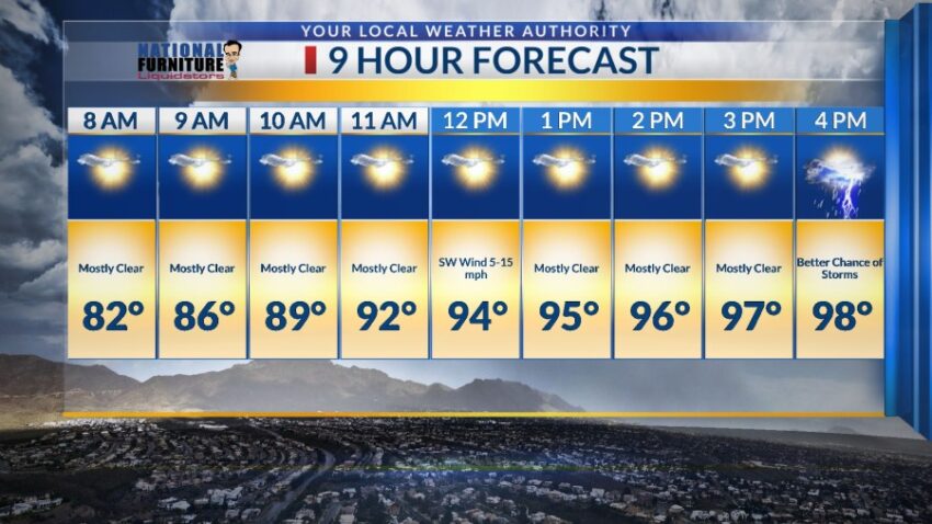
It was a pretty quiet day today with a high of 98 as monsoonal moisture shifted to the west. Tomorrow, that moisture begins to slowly percolate back into the Borderland as storm chances start to rise again. Here’s your exclusive 9-Hour Forecast for Wednesday:

TONIGHT: The skies will be partly cloudy with only the slightest chance to see some distant lightning and feel occasional gusts. The chances of rain go away tonight, and overnight, we’ll see a few clouds. The SW winds will range from 5-15 mph, and the low will be a warm 77.
FORECAST: Wednesday will be partly cloudy and 98 with a chance of late day t-showers. The chance of rain goes up a bit on Wednesday as mid-level moisture begins to charge back up. The SW winds will range from 5-15 mph. Thursday will be partly cloudy and 97 with widely scattered late day t-showers. The threat of heavy rainfall out of individual storms increases on Thursday. Friday will be partly cloudy and 98 with scattered late day t-showers. A heat wave begins to build back up starting Saturday. Saturday will be mostly sunny and 100 with only distant lightning in the evening. Sunday will be partly cloudy and 101 with isolated late day t-storms. Monday will be partly cloudy and 100 with only a slight chance of isolated area t-storms.

Read: Read More