


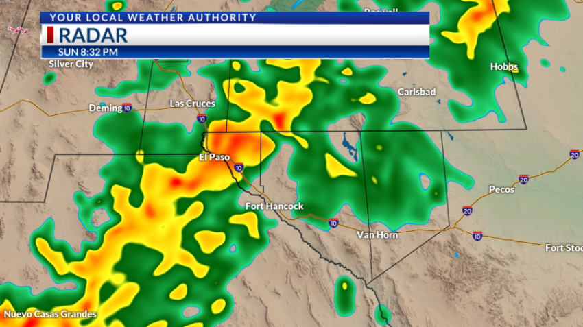
EL PASO, Texas (KTSM) — Happy Sunday, Borderland. Hopefully, you enjoyed the drier conditions, because storm chances return this upcoming forecast period starting Sunday night.

For the El Paso region, storms are appearing on the radar as early as 7 p.m. and continue through the later evening hours to midnight. Winds will be lightly blowing from the northeast at 5-10 mph with a low around 73.
Las Cruces is showing a similar trend with a cooler low around 68 and winds coming in from the northwest.
Monday will bring mostly sunny skies through the morning into the afternoon with light winds and a high near 97. Storm chances appear again in the later afternoon to evening hours. The low will be in the lower 70s.
Tuesday through Thursday, rain and storm chances will be hit or miss. More than likely these storms will be isolated and scattered and begin making landfall in the nightime hours. Highs will be in the middle to upper 90s and be closer to average than what was seen last week. Lows will be in the 70s.
Friday into the weekend, moisture increases and so do the chances to see stronger storms that will bring heavy rainfall. Weekend highs will be near the middle 90s with lows in the lower 70s.
 Read: Read More