


What a difference a day makes! Yesterday, the threat of heavy rainfall and strong storms. Today, a few isolated (mainly distant) storms with clear skies overnight. The atmosphere is similar tomorrow… fairly stable, modest moisture. We’ll have only a slight chance of isolated area storms. All that changes on Friday as the threat of strong storms roars back. Here’s your exclusive 9-Hour Forecast for Thursday with your 9-Day Forecast below.

TONIGHT: The skies will be partly cloudy early with only the slightest chance of an isolated area t-storm. Rain chances have dropped dramatically from yesterday, so expect no threat tonight of heavy rainfall. Overnight, the skies will be clear. The SE winds will range from 5-10 mph, and the low will drop 74.
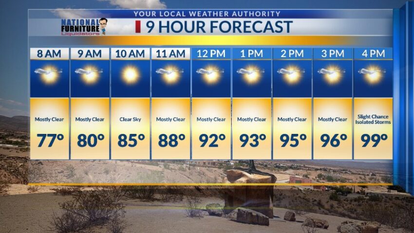
FORECAST: Thursday will be partly cloudy and 99 with only the slightest chance of isolated late day t-storms. The SW winds will range from 5-15 mph. Elevated moisture and instability charge up potentially strong storms for the week’s end. Friday will be partly cloudy and 95 with widely scattered showers and t-showers. Some storms may produce heavy rainfall. Saturday will be partly to mostly cloudy with scattered showers and t-showers. Some storms may produce heavy rainfall. Saturday’s high: 90. The threat of heavy rainfall out of some storms extends into Sunday as well. Sunday will be partly to mostly cloudy with scattered showers and t-showers. Sunday’s high: 91. Monday will be 95 and partly cloudy with isolated PM t-storms. The threat of heavy rainfall goes down significantly on Monday. Tuesday will be mostly sunny and 99.

Read: Read More