


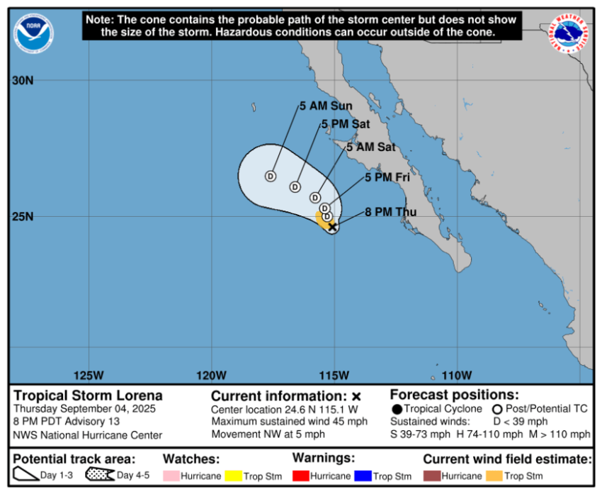
The National Hurricane Center has revised the path of Tropical Storm Lorena, and the new path places the Borderland in the best case scenario. Yes, we’ll still have scattered showers on both Friday and Saturday, but the core of the decaying tropical storm will remain closer to the Baja California. Any threat of heavy rainfall is gone.

Here’s your 9-Hour Forecast for a cool, rainy Friday and your 9-Day Forecast below.

TONIGHT: The skies will be overcast with a chance of scattered showers moving in late evening and overnight. The NW Winds will range from 5-15 mph, and the low will drop to 67.
FORECAST: Friday will be overcast as the moisture remnants of Lorena pass into southwestern New Mexico and west Texas. Expect periodic rain showers on and off and a cooler day with a high of 79 due to the thick cloud cover. Winds will shift SW at 5-20 mph. Saturday will be partly to mostly cloudy with scattered showers and t-showers. With a high of 85, we’ll see moments of sunshine mixed with the clouds. We could see brief, moderate rainfall. Saturday’s high: 85. Sunday will be partly cloudy and 90 with a slight chance of isolated showers. Monday will be mostly sunny and 95. Tuesday will be sunny and 96.

Read: Read More