


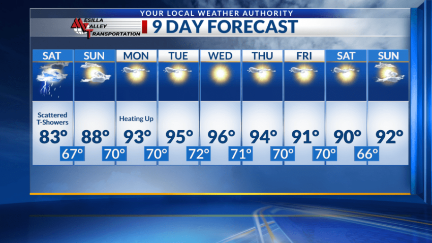
EL PASO, Texas (KTSM) — Happy Friday, Borderland. The workweek ended with mostly overcast skies and cooler temperatures. The risk of heavy rain and flooding is pretty much out of the picture going into Friday night, but the potential to see these events continues into Saturday due to higher chances for thunderstorms.
Instability in the atmosphere grows Saturday with less cloud cover and more surface warming, creating ideal conditions for scattered showers and storms in the late afternoon and early evening hours. The high will be in the low to mid-80s with the low in the upper 60s. Winds will be light around 5 mph.
For Sunday, conditions begin to clear. Less clouds will be present as moisture exits the region with mostly sunny skies and a high near 88. The winds will be light and variable with a low in the 70s.
Starting Monday, the region will see a slight warming up trend with highs in the low to mid-90s through the rest of the forecast period. Lows will be mostly in the lower 70s with light and variable winds. Mostly sunny skies will prevail throughout the week.
 Read: Read More