


Finally, you can feel the heat starting to pull back. Yes, we made it to 95 today, which is still hot, but moving in the right direction. Just in time for Football Friday Night (this would be the third in a row), we have a chance of evening t-storms. I envision these storms to have lightning and brief rain. Storms with heavier rainfall come in on Saturday. Here’s your exclusive 9-Day Forecast for Friday with your 9-Day Forecast below.

TONIGHT: The skies will be mostly clear early in the evening with just a few clouds but will turn clear overnight. The SW winds will range from 5-10 mph, and the low will drop to 73.
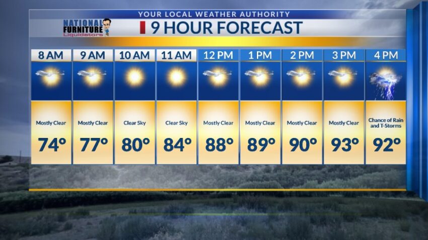
FORECAST: Friday will start out sunny but turn partly to mostly cloudy with isolated evening t-storms. Individual storms may pose and lightning and brief rain threat with occasional area gusts. Friday’s high: 93. Saturday will usher in significantly more moisture and instability, meaning the possibility of much stronger t-showers. Expect storms to be widely scattered with brief, heavy rainfall. Saturday’s high: 90. Sunday will be partly cloudy with only a slight chance of isolated area t-storms. Sunday should be a pretty quiet, nice day with a high of 91. Monday will be partly to mostly cloudy with widely scattered showers and t-showers, some bringing heavy rain. If there was a day where we could experience localized flooding, it’s Monday with a high of 86. Tuesday will be partly cloudy with only a slight chance of t-storms. Tuesday’s high: 85. Wednesday will be partly cloudy with a high of 88.

Read: Read More