


If you’re tired of the heat, I have good news. A cool front blows in overnight tonight! Here’s your exclusive 9-Hour Forecast for Wednesday with your 9-Day Forecast below.

TONIGHT: The skies will be partly to mostly cloudy with a chance of isolated area showers and t-storms. At around midnight (give or take), the winds will abruptly shift NE-east with an arriving cool front. Gusts will be stronger on the west slopes. The front may also trigger a few showers as it pushes through in the early morning hours. The low will drop to 67.
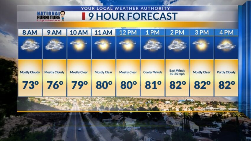
FORECAST: Wednesday will be partly to mostly cloudy and cooler as the first cool front of the season blows in. East winds will range from 10-25 mph with stronger gusts on the west slopes. The high will drop to 82. Thursday will be partly cloudy and 87 with a slight chance isolated PM area t-storms. Friday will be partly cloudy and 89 with a better chance of isolated PM t-showers. Some storms may produce brief, heavy rainfall. Saturday will be mostly cloudy with a few showers here and there. Saturday’s high: 88. Sunday will be mostly cloudy with a few scattered showers and t-showers. Sunday’s high: 84. Monday will be mostly sunny and 85. Tuesday will be mostly sunny and 90.

Read: Read More