


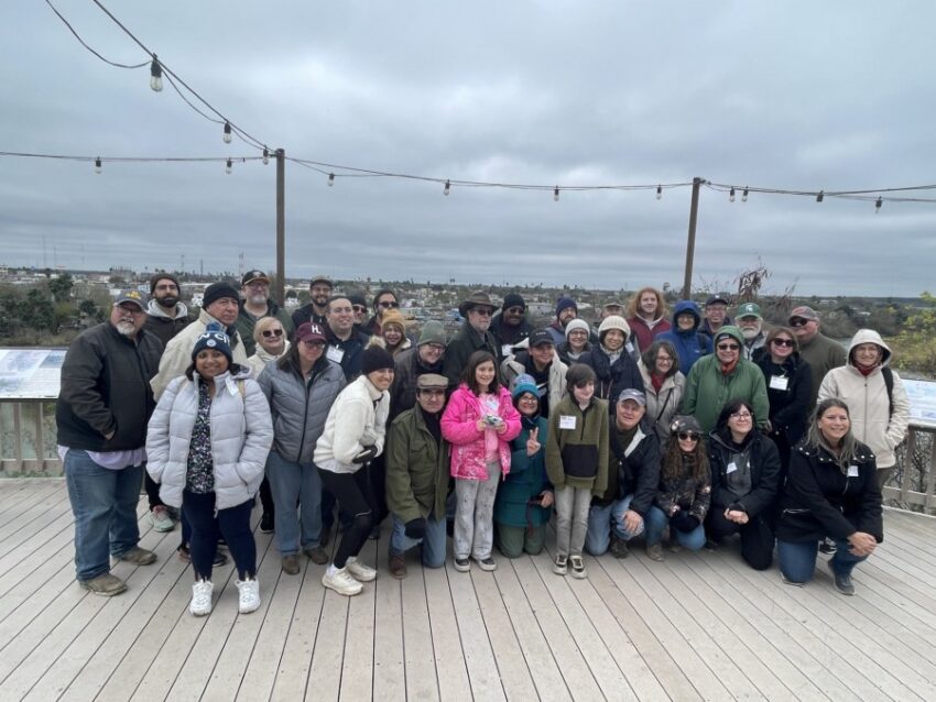
RIO GRANDE VALLEY, Texas (Border Report) — Dozens of people got to explore historic and ancient remains on the South Texas border in the Rio Grande Valley — some dating millions of years ago — as part of a day-long community bus tour recently sponsored by the University of Texas Rio Grande Valley.
“You’re guys are about to go on an adventure. An adventure that’s going to take you 50 million years into the past and it’s going to help you understand how people have lived in and around this environment for the last 20-plus thousand years,” UTRGV Associate Dean Russell Skrownek told the 42 on board as they prepared to depart the university’s Edinburg campus Saturday morning.
Border Report got to go on the charter bus as it traveled from one historic site to another along the border with Mexico in Hidalgo and Starr counties. It was part of UTRGV’s Community Historical Archaeology Project with Schools, or CHAPS, program.
The program also offers archaeologically and historical information to local teachers in grades K through 12 to use in curriculum preparation.
Normally these bus tours are held for teachers. But Saturday they invited many from the community, as well as academics.
And despite a cold rain in what normally is subtropic terrain, all interviewed by Border Report said it was exciting and stimulating.
Many said they had passed some of these sites for decades and never realized its historic significance. This is why they call the tour Ancient Landscapes of South Texas, Hiding in Plain Sight, says CHAPS manager Roseann Bacha-Garza.
Volcanic explosion 47 million years ago
This includes a 47-million-year-old volcanic ash formation that is visible from Highway 83 in Starr County, outside Rio Grande City.

It’s part of the Catahoula Formation and UTRGV geology Professor Juan Gonzalez says the volcanic explosion was one giant event that happened about 500 miles ago in the Sierra Madre Mountains, in what is now Mexico. Winds carried the ash to this ridge, which at the time was the shoreline.
Everything else was underwater.
“Where we are, none of this was above water,” Gonzalez told the group.
“’Cause that was the shoreline. From here all the way into Louisiana. Into Alabama. So you can see it on Google Earth,” Bacha-Garza said.
The volcanic explosion painted the shoreline with ash and forever changed the landscape.
Gonzalez says they know it was from one giant event because they scientifically tested it using neutron activation analysis.
“The chemistry doesn’t change from bottom to the top. So it’s basically one single event,” Gonzalez said.
Now gray slippery ash slides off the cliff, while pinker ash sits at the top. And all of it is beside a modern-day subdivision.
Petrified palm trees and oyster shells
A few miles west in the small border town of Roma, a house is lined with petrified palm tree stumps and giant oyster shell remains that also were formed from the volcanic explosion. Years of rain and sediment preserved the pieces and turned them into stone.


Bacha-Garza says the former owner of the home in the 1930s hand drug these pieces that he found in and around Starr County and brought them back to his yard to create a natural barrier.
He is deceased now, and she says they are trying to convince city officials to turn it into a historic park that the university can help to preserve and promote and use to educate future generations.

The mineralized wood has no organic material left. Like fossils, the petrification takes away all organic materials and replaces them with minerals, Skrownek, director of the CHAPS program, told Border Report.
Throughout the day, Skrownek entertained the tour with stories about how what they were seeing has transformed the landscape into what it has become today.
San Isidro water wells
At the San Isidro water wells in eastern Starr County, he told about how the hand-dug wells brought water to cattle in areas where previously there was none. And once cattle populated the lands, they spread seeds that caused trees and plants to grow and turned once-grassland into what is now brushland.
“It actually started down at the river. And they have this wonderful system of fertilizer that’s built in so they carry up all of these seeds and plants and those packages get deposited up here and we go from the grassland to the brushlands,” Skrownek said.
The wells, called norias, were built by Mexican rancheros in the 1800s. They dug down 30 feet through caliche rock to find water by following the root lines of certain trees that early settlers knew could seek out the water table.
“Picture yourself being here 200 years ago, right. No running water. It was a very different landscape,” Gonzalez said.
The water was brought up with a system of pulleys and stored in large structures, 10 of which are still visible throughout Starr and Hidalgo counties.
Gabby Garza, a UTRGV alumni, came from Houston with her 13-year-old son Paul Garza for the tour. Paul wants to study geography and oil and gas. He said he was surprised to learn that La Sal del Rey — a salt lake in Hidalgo County — was formed by a wind depression.
“This has been a great experience, a great hands-on experience,” Gabby Garza said. “I feel that a lot of the parents and children would also benefit from tours like these and programs like these because they get so much knowledge about their culture and everything that’s around them.”
La Sal del Rey lake
The La Sal del Rey lake is about 30 miles north of McAllen. Gonzalez says it really isn’t a lake supplied by ground water, but by rains. The landscape was carved by prevailing winds that dug it out and as it rains the water fills up. If there’s no rain, then it’s a dry salt bed that is walkable.
On Saturday, the rain was coming hard and sideways and the lake was not walkable. But visitors stood on a visitor’s deck and learned that it formed about 5,000 years ago.

Roma bluffs
The tour ended in Roma at the historic bluffs, which overlook the Rio Grande, and the Mexican city of Miguel Aleman, in the state of Tamaulipas.
This was the last commercial steamboat stop on the river in the early 1900s because after this point the river is not navigable. A steamboat made it to Laredo once, but they said it got stuck and had to wait two years, Skrownek said.
That’s part of why railroad developed in Laredo and parts West, he said. And that’s what helps to drive border economies today.
The bluffs show how the Rio Grande carved a channel through the land, which now divides countries.

There even are small islands in the middle of the Rio Grande now, which human smugglers use to illegally traffic people into the United States, according to Border Patrol.
One nearby island, Fronton Island, has even been bulldozed and turned into a peninsula by Gov. Greg Abbott’s Operation Lone Star forces, to prevent illegal crossings.
The CHAPS project also offers a Civil War Trail. And it has a Pathways to Freedom Project that highlights how South Texas was used for the Underground Railroad and was a destination for slaves to head south into Mexico to achieve their freedom.
Next month, representatives from the Harriet Tubman Museum and Educational Center are coming to the Rio Grande Valley’s first “Walking Southern Roads to Freedom” event March 3 to March 9, sponsored by the CHAPS program. Participants plan to walk over 60 miles in one week and will tour several historic sites and landmarks within Hidalgo County, like La Sal del Rey, and the Jackson Ranch Church and Eli Jackson cemeteries, which were part of the Underground Railroad, she told Border Report.
Sandra Sanchez can be reached at SSanchez@BorderReport.com.
 Read: Read More