


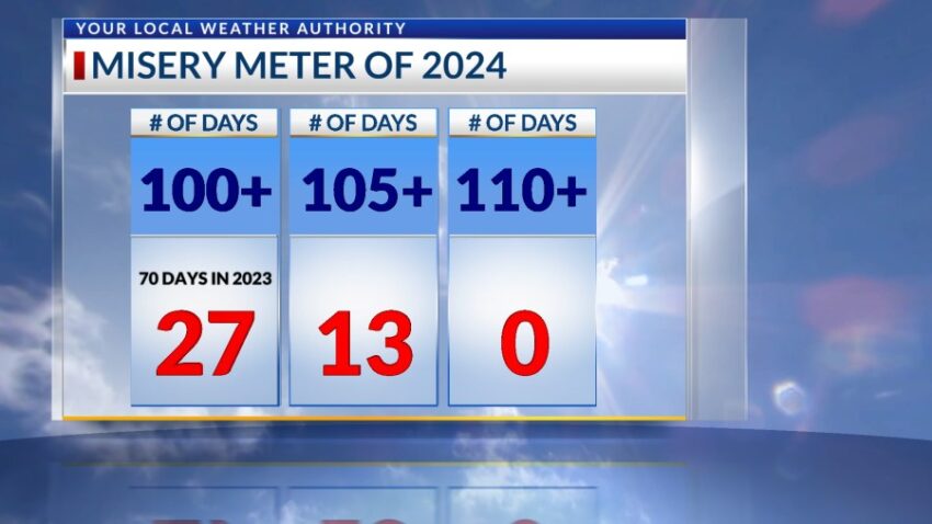
Unfortunately, we added to the “Misery Meter” Sunday and today. The official high is 101, and the record is 106 set in 1963. We heat up a few more degrees Tuesday to 103. In mid July, we should be seeing regular, daily t-showers, but lately, it’s only been a lot of heat and sunshine, such as the picture of UTEP sent in by Weather Watcher Rick Smith.
TONIGHT: The skies will be partly cloudy early in the evening but turn clear overnight. The SE winds will range from 5-15 mph, and the low will drop to 76.
FORECAST: Tuesday will be partly cloudy and very hot with a high of 103. Afternoon clouds will build up in the afternoon heat. The SE winds will range from 5-15 mph. Wednesday will be partly cloudy and hot as well with a high of 101. The SE winds will range from 5-15 mph. Thursday will be partly cloudy with isolated late day t-storms. Thursday’s high: 99. Friday will be partly cloudy with isolated late day t-storms. Friday’s high: 98. Saturday will be partly cloudy with scattered late day t-showers. Saturday will be 97.
Read: Read More