


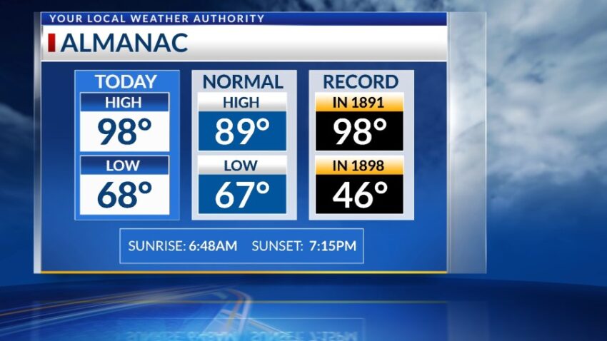
Record heat today! The official high is 98, which ties the old record of 98 set in 1891. We’re going to make another pass near 100 next Monday. I’m predicting 98, so we’ll see how close we get.
TONIGHT: The skies will be clear overnight, and the winds will be a little gusty at times early in the evening. The SW winds will range from 10-25 mph but will die down through the night. The low will drop to 70.
FORECAST: Friday will be mostly sunny to partly cloudy as we cool down a few degrees. With a high of 96, the SW winds will range from 5-15 mph. Saturday will be partly cloudy and breezy with a high of 95. Sunday will be mostly sunny with just a few clouds and a high of 96. Monday will be sunny as we get very, very close to 100 again with a high of 98. The warm SW winds will gust to near 25 mph. Tuesday will be partly to mostly cloudy and windy with scattered late day t-showers. Tuesday’s high: 92. Wednesday will be sunny and 90.
Read: Read More