


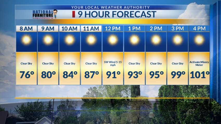
We certainly dried out today… you could feel the drier air. With a high today of 98, get ready to get even hotter for the weekend ahead. Here’s your exclusive 9-Hour Forecast for Friday:

Here’s the Misery Meter. We’re probably going to add a few to the first column this weekend.

TONIGHT: The skies will be partly cloudy early in the evening with skies clearing overnight. We shall stay storm free tonight. The SW winds will range from 5-15 mph, and the low will drop to 74.
FORECAST: Friday will be mostly sunny and very hot with a high of 101. High pressure builds up for the weekend, raising temperatures. The SW winds will range from 5-15 mph. Saturday will be partly cloudy with isolated evening t-storms in a hit-or-miss pattern, especially in the east part of El Paso County. Saturday’s high: 102. Sunday will be partly cloudy and 99 with widely scattered showers and t-showers. Some storms may produce some brief, heavy rainfall. Monday will be partly to mostly cloudy with widely scattered showers and t-showers. Some storms may produce brief, heavy rainfall. Monday’s high: 92. Tuesday will be partly cloudy and 95 with only a slight chance of isolated area t-storms. Wednesday will be mostly sunny and 96.

Read: Read More