


Our high today was 73. That’s 8 degrees above normal. The record on this day is 85 set in 2016. The peak gust as of this article was 35 mph, but stronger gusts will still be possible until the winds die down and then shift direction overnight. Here’s your exclusive 9-Hour Forecast for Wednesday.

TONIGHT: Expect gusty winds from the W-NW early in the evening. Those winds will range from 15-40 mph with stronger gusts on the east slopes. A dusty haze will be likely by early evening. Overnight, right around midnight, the winds will shift direction. The east winds will be stronger on the west slopes, and the low will be 38.
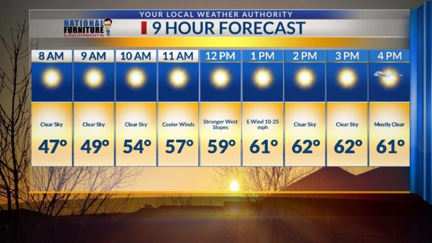
FORECAST: Wednesday will be cooler with a high of 62. The east winds will range from 15-25 mph with stronger gusts on the west slopes. The low Wednesday night will drop to 29 as colder air moves in from the east. Thursday will be partly cloudy with chilly winds from the east and a high of 59. The east winds will range from 10-20 mph. Friday will be sunny with a shift in the winds back to the SW. Those SW winds will range from 15-35 mph, and the high will climb to 70. Saturday will be mostly sunny with lighter winds. Saturday’s high: 72. Sunday will be sunny with moderate winds and a high of 73. The SW winds will gust to near 30 mph. Monday will be sunny and 80 as high pressure builds up in a dramatic way. Tuesday will be mostly sunny and 81.

Read: Read More