


What a change from yesterday. On Wednesday, fast moving t-showers dropped heavy rain (0.38 inches at the airport) in a matter of minutes. Today, a few clouds and a lot of sunshine. Here’s exclusive 9-Day Forecast for Friday and your 9-Day Forecast below.

TONIGHT: The skies will be partly cloudy early in the evening but torn clear overnight. The SE winds will range from 5-10 mph, and the low will be 72.
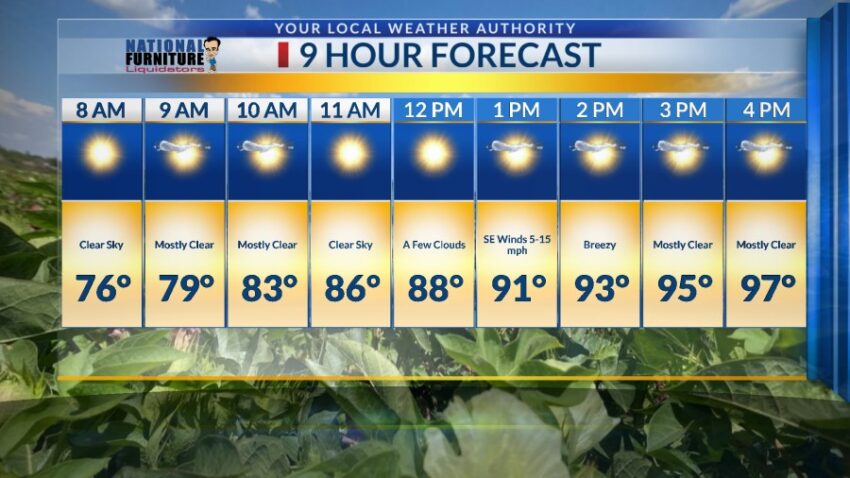
FORECAST: Friday will be mostly sunny, hot, and dry with a high of 98. Expect a few afternoon clouds and SE breezes at 5-15 mph. Saturday will be mostly sunny and hot with a high of 97. Sunday will be sunny and breezy with a high of 96. Monday will be transitional day, as moisture starts to return to the Borderland. The skies will be partly cloudy with a slight chance of isolated PM storms. Monday’s high: 96. Tuesday will bring potentially strong t-showers with a heavy rain threat. Skies will be partly to mostly cloudy, and the high will be 93. That threat of heavy rain lasts into Wednesday, which will have mostly cloudy skies and scattered t-showers. Wednesday’s high: 89.

Read: Read More