



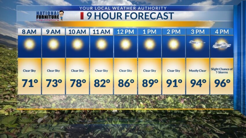
It is extremely unusual to get a chance of rain in May and the first two weeks of June. The monsoon starts around June 15 with the best storm and rain chances between June 15 and August 30. That’s why this upcoming “mini-monsoon” is so exciting. The storms begin to ease into El Paso County starting tomorrow. Here’s your exclusive 9-Day Forecast for Wednesday:

TONIGHT: The skies will be partly cloudy early in the evening, turning clear overnight. The variable winds will range from 5-10 mph. T-storms have cropped up in Otero County of New Mexico, so we may experience a few random gusts as those storms break apart. The low will be 66.
FORECAST: Wednesday will be partly cloudy with a noticeable increase in humidity by the afternoon. With a high of 96, expect a slight chance of isolated area t-storms, especially east of El Paso. Thursday will be partly cloudy with late day t-storms and a high of 99. Friday will be 97 with widely scattered late day t-showers. Some storms may produce brief, heavy rainfall. Saturday will be partly to mostly cloudy with isolated late day t-storms. Some storms may produce brief, heavy rainfall. Saturday’s high: 96. Sunday will be partly to mostly cloudy and 95 with scattered showers and t-showers. Brief, heavy rain will be possible. On Monday, we abruptly dry out and heat up again. Monday will be sunny and moderately windy (no dust) with a high of 96. Tuesday will be sunny and 99.

Read: Read More