


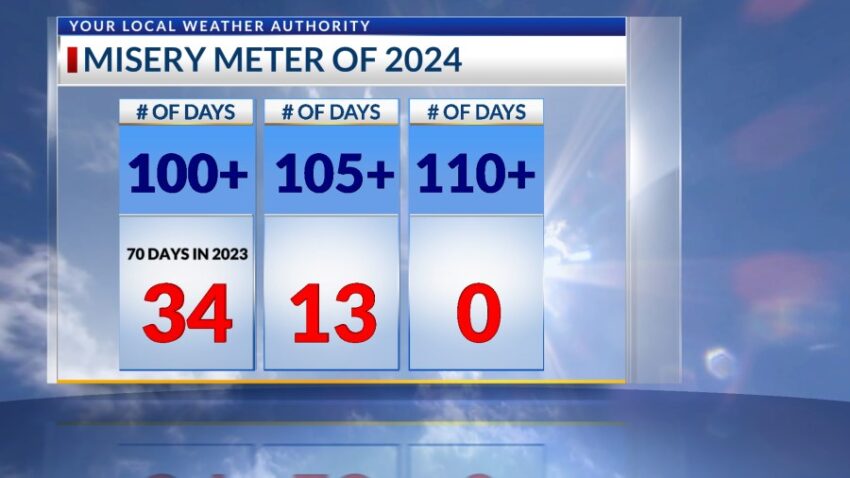
That “Misery Meter” has been busy lately. Today is our 34th day of triple-digit heat with an official high of 102. The record is 105 set in 1960. I’m predicting 105 for tomorrow. If we hit that number, we will still be 4 degrees from the record of 109 set in 2020.
TONIGHT: The skies will be partly cloudy with scattered t-showers. Some individual storms may produce brief, heavy rainfall. Overnight, the t-showers will taper off as skies become mostly clear. The variable winds will range from 5-15 mph with occasional gusts, and the low will drop to 77.
FORECAST: Tuesday will be even hotter with a high of 105. Expect partly cloudy skies with scattered late day t-showers. Brief rain is possible out of individual storms. The SW winds will range from 5-15 mph. Wednesday will be partly cloudy and 103. We’ll have a slight chance of isolated area t-storms on Wednesday evening. Thursday will be extremely hot with a high of 106. Isolated late day t-showers will crop up with the afternoon heat. Friday will be mostly sunny and 105. Saturday will be mostly sunny and 102. Sunday will be mostly sunny with just a few clouds and a high of 100.
Read: Read More