


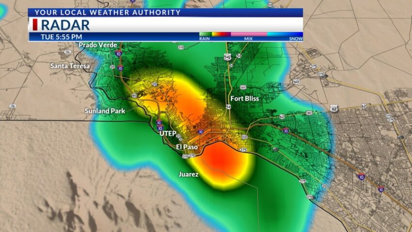
The high today was 104! That’s our 35th triple-digit day of the year. The record is 109 set in 2020. The heat stirred up the scattered t-showers. As we saw right downtown and over I-10 during the middle of the evening commute, a significant thunderstorm dumped quite a bit of heavy rainfall quickly. Do not drive into flooded roadways. More t-showers are likely late into the overnight hours.
TONIGHT: The skies will be partly cloudy with scattered t-showers. Some individual storms may produce brief, heavy rainfall. Overnight, the t-showers will taper off as skies become mostly clear. The SW winds will range from 5-15 mph with occasional gusts, and the low will drop to 80.
FORECAST: Wednesday will be partly cloudy and 103. Expect scattered t-showers in the late afternoon and evening. Some storms may produce some brief rainfall. The SW winds will range from 5-15 mph. High pressure reaches its maximum over the Borderland on Thursday and Friday. Thursday will be extremely hot with a high of 106. Isolated late day t-showers will crop up with the afternoon heat. Friday will also be extremely hot with a high of 106. We’ll have only a slight chance of isolated PM storms on Friday evening. Saturday will be mostly sunny and 102. Sunday will be partly cloudy with scattered late day t-showers. Sunday’s high: 100. Monday will be partly to mostly cloudy with a high of 98. We’ll see a few isolated area t-storms on Monday.
Read: Read More