


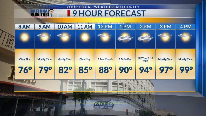
We experienced a few isolated showers and t-storms today, and we may see a few more this evening. The difference between tonight’s storms and yesterday’s is the speed at which the storms are moving tonight. We face no threat of flooding because isolated storms are moving SW at 20 to 25 mph. The rain may be intense, but it won’t last long. Tomorrow, the storms go away as we heat up. Here’s your exclusive 9-Hour Forecast for Thursday with your 9-Day Forecast below.

TONIGHT: The skies will be partly cloudy with isolated, fast-moving showers and t-storms. Any rain produced by these storms would be brief and likely not cause any flooding. Occasional gusts will be possible as well, but generally the SE winds will range from 5-15 mph. The storms will taper off this evening with clear skies overnight as the low drops to 72.
FORECAST: Thursday will be mostly sunny with just a few clouds and hot with a high of 99. The SE winds will range from 5-10 mph. Friday will be mostly sunny, hot, and dry with a high of 98. Saturday will be sunny and hot with a high of 98. Sunday will be sunny and 97. Monday will be sunny and 97. Tuesday will be partly cloudy and 96 with a very slight chance of isolated area storms. Wednesday will bring a return of the elevated moisture and instability. Thus, expect widely scattered t-showers with the potential for brief, heavy rain. Wednesday’s high: 95.

Read: Read More