


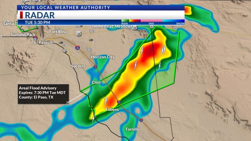
We had the potential for strong t-showers today, and those storms have delivered quite a bit of rainfall in various parts of town. The east side of El Paso County is under a Flood Advisory until 7:30 PM. At the storm’s core, right at the border of Hudspeth County, radar indicated small hail contamination. One to two inches of rain has already fallen from the county line through the eastern edge of Horizon City down to Fabens and Clint.

The west side and Upper Valley is under a Flash Flood Warning until 6:15 due to flooding along Doniphan and other streets.

Yes, we will have a chance of isolated t-storms Wednesday afternoon and evening, but the chance for very heavy rain goes way down. Here’s your exclusive 9-Hour Forecast with your 9-Day Forecast below.

TONIGHT: The skies will be partly to mostly cloudy with widely scattered showers and t-showers. Some storms may become strong and produce brief, heavy rainfall as well as occasional gusts. The SE winds will range from 5-15 mph, and the low will drop to 73 as storms taper off late evening.
FORECAST: Wednesday will be partly cloudy and 98 with isolated PM t-storms. The storms will pop up in a random, hit-or-miss pattern, and though individual storms may produce rain, the rain would be brief. Thursday will be mostly sunny and hot with a high of 100. The SE winds will range from 5-15 mph. Friday will be mostly sunny, hot, and dry with a high of 98. Saturday will be sunny and 98. Sunday will be sunny and 97. Monday will be partly cloudy and 96. Tuesday will be partly cloudy and 96 with isolated PM t-storms.

Read: Read More