


Storms have arrived. El Paso County is under a Severe T-Storm Watch until 9 PM. A Severe T-Storm Warning is posted for Chaparral until 6:15 PM with flooding and ping pong size hail. More potentially strong storms and heavy rainfall will be likely in other parts of the county.
In Ruidoso, the National Weather Service has issued A FLASH FLOOD EMERGENCY in effect until 11:15 PM. Some locations that will experience flash flooding include Ruidoso, Ruidoso Downs, San Patricio, Hondo, Tinnie, Glencoe, Sunset and Hollywood. This includes Highway 380 near Mile Marker 105…and near Mile Marker 107.
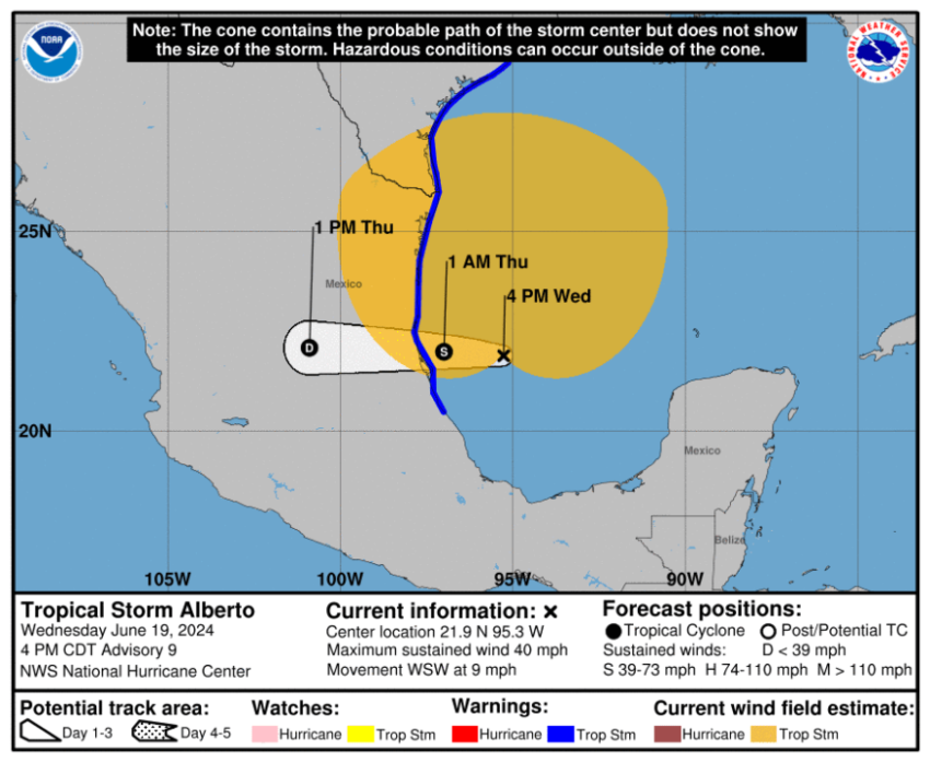
Our official high in El Paso today is 106. That’s very close to the old record of 108 set in 1960. The extreme heat has fired up some powerful storms to be followed tomorrow by tropical storm clouds and a continued threat of heavy rainfall. KTSM was the first station to alert you about the surge in tropical moisture from what is Tropical Storm Alberto in the Gulf of Mexico. That storm will break apart over Mexico, but the surge in moisture will keep us cloudy for two days.
TONIGHT: KTSM has issued a Weather Authority Alert for the potential of strong storms tonight and the threat of heavy rainfall Thursday and Friday. The skies will be partly cloudy with widely scattered showers and t-showers. El Paso County is under a Severe T-Storm Watch until 9PM. Conditions make strong storms possible with heavy rain, strong winds, and even hail. The SE winds will range from 10-30 mph with stronger gusts near storms. The low will drop to 73.
FORECAST: Summer officially begins Thursday afternoon at 2:51 PM. A significant amount of tropical moisture from Tropical Storm Alberto will pass over the Borderland starting Thursday morning. Thursday will be mostly cloudy to overcast and significantly cooler with a high of 84. Expect widely scattered showers and t-showers. The SE winds will range from 10-30 mph, and humidity levels will be high. We’ll face the threat of heavy rainfall from Thursday evening through midday Friday. Friday will be cloudy with scattered showers and t-showers. The SE winds will range from 10-25 mph. The skies will turn partly cloudy by late Friday. On Saturday, the moisture thins out, the sunshine comes back out, and the high pops up to 101. Sunday will be partly cloudy and hot with a high of 105. Extreme heat returns to the Borderland starting Monday. Monday will be partly cloudy with a very slight storm chance and a high of 106. Tuesday will be mostly sunny and 107.
Read: Read More