


Today is El Paso’s 14th triple-digit day of the year. Of course, all eyes are on the fires in Ruidoso and the chance of rain starting late tomorrow afternoon. I have some very good news; the Borderland can expect t-storms to form late Wednesday afternoon/evening. Below is your exclusive 9-Hour Forecast for Ruidoso. The heavier rainfall will hit on Thursday and Friday with heavy rain chances in El Paso as well.
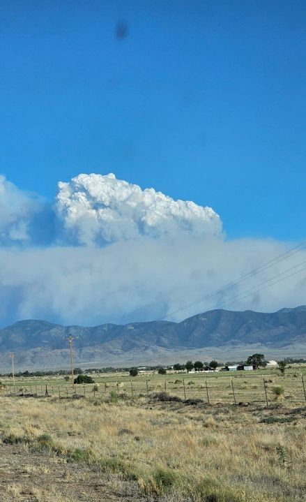
Weather Watcher George Selters sent this image of the smoke billowing up into a giant cloud near Ruidoso.
TONIGHT: The skies will be clear overnight, and the hot breezes from the SW will slowly die down. The SW winds will range from 10-25 mph with the strongest gusts on the east slopes of the mountains. The low will drop to 72.
FORECAST: KTSM has issued a Weather Authority Alert due to storm chances Wednesday evening and the threat of heavy rain fall Thursday and Friday. Wednesday will be partly cloudy with scattered late day t-storms. The winds will shift SE at 10-30 mph, and you’ll feel an increase in humidity by the middle of the afternoon. Wednesday’s high: 103. Summer officially begins Thursday afternoon at 2:51 PM. A significant amount of tropical moisture will pass over the Borderland starting Thursday morning. Thursday will be mostly cloudy to overcast and significantly cooler with a high of 80*, which may occur at midnight. Expect widely scattered showers and t-showers. We’ll face the threat of heavy rainfall from Thursday evening through midday Friday. Friday will be cloudy with scattered showers and the threat of heavy rainfall, especially in the morning. On Saturday, the moisture thins out, the sunshine comes back out, and the high pops up to 100. Sunday will be partly cloudy and hot with a high of 104. We’ll have a slight chance of isolated storms late Sunday.
Read: Read More