


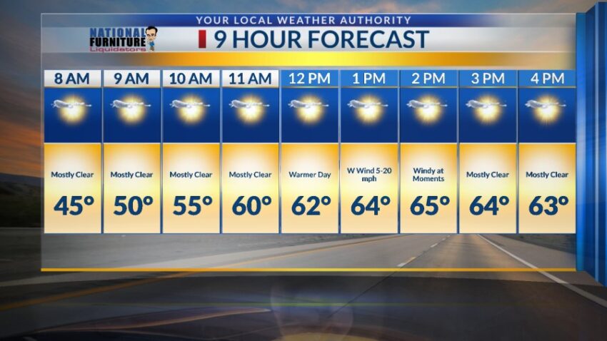
That cold arctic air mass over Texas doesn’t seem to want to go anywhere! Our official high today was 56, which is 2 degrees colder than yesterday. The low at the airport was 29, which is 1 degree colder than yesterday. Normal is 65, and the record is 83 set in 1972. All that changes for our Saturday as a low-pressure disturbance stirs up some warmer winds from the west. Here’s your exclusive 9-Hour Forecast for Saturday.

TONIGHT: The skies will be partly cloudy overnight. The E-SE winds will range from 5-15 mph with stronger gusts on the western slopes of the mountains. The low will drop to 33.
FORECAST: Saturday will be mostly sunny with just a few clouds and a warmer afternoon. A passing low-pressure system will cause the winds to shift W-SW at 5-20 mph. We’ll be windy at times (no dust) with a high of 65. Sunday will be sunny and breezy as we warm up to 73. The NW winds will range from 5-20 mph. On Monday, high pressure builds up in a dramatic way. Monday will be sunny and very warm with a high of 81. The west winds will gust to near 20 mph. Tuesday will be mostly sunny and 83, our warmest day of the week as high pressure reaches its maximum. Wednesday will be partly cloudy with a high of 80. The winds will become gusty late Wednesday in advance of a mild cool front on Thursday. Thursday will be partly to mostly cloudy and windy on the west slopes of the mountains. Thursday’s high: 75. Friday will be mostly sunny to partly cloudy with a high of 79. Saturday will be partly to mostly cloudy and cooler with a high of 67.

Read: Read More