


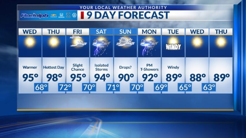
Get ready for what could be one of our last surges of heat! The high today is 93. The record is 102 set in 2023, and normal for this day is 90. Tomorrow, we move up to 95, and we shall be very, very close to 100 on Thursday.
TONIGHT: The skies will be clear, and the south winds will range from 5-10 mph. The low will drop to 64.
FORECAST: Wednesday will be sunny and 95. The hot, dry SW breezes will range from 5-15 mph. Thursday will be mostly sunny with a high of 98, which will be the hottest day of the week. The SW winds will range from 10-25 mph. Friday will be partly cloudy, and we’ll feel the additional humidity. Expect a slight chance of isolated area t-storms as the high climbs to 95. Saturday will be partly to mostly cloudy and 94 with a better chance of isolated area t-showers. Sunday will be partly to mostly cloudy with a slight chance of a few raindrops here and there. Sunday’s high: 90. Monday will be partly to mostly cloudy with scattered late day t-showers.
Read: Read More