


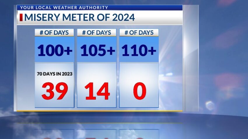
It was a toasty 103 today. The record is 107 set in 2023. Today is our 39th day of triple-digit heat, and if my forecast is accurate, we’ll add another 7 days to the “Misery Meter” this week.
TONIGHT: The skies will be partly cloudy with scattered showers and t-showers. Some storms may produce strong wind gusts and brief, heavy rain. The SE winds will range from 5-15 mph, and we should expect overnight clearing. The low will be 75.
FORECAST: Monday will be partly cloudy with a high of 102. We’ll have only a slight chance of isolated area showers and t-storms, and the chance of rain goes down. The SE winds will range from 5-15 mph. Tuesday will be mostly sunny with just a few clouds and a high of 100. Wednesday will be partly cloudy and 103. We’ll see widely scattered showers and t-showers by Wednesday night. Thursday will be partly cloudy and hot with a high of 104. Isolated late day storms will crop up with the afternoon heating. Friday will be partly cloudy and 102 with a slight chance of isolated late day storms.
Read: Read More