


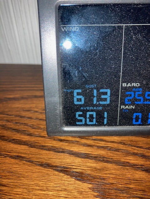
What a horrible night for winds! That cold front arrived just as expected. Our Weather Watcher Bruce has his own weather station near Belvedere and Resler, and it reported a peak gust this morning of 61.3 mph! At the airport, the peak gust was 42 mph. That cold front certainly dropped the high, which was 67 today. Here’s your exclusive 9-Hour Forecast for a much better day tomorrow.


TONIGHT: The skies will be clear, and the gusty winds will slowly diminish through the evening hours. The east winds have been strong and gusty with a cool front. Those east winds will range from 10-25 with stronger gusts on the west slopes. Past midnight, the winds will be light and variable. The low will drop to 39.
FORECAST: Friday will be a nearly perfect day with sunshine, just a few clouds here and there, light winds, and a high of 72. The variable winds will range from 5-10 mph. Saturday will be sunny and breezy with a high of 80. The SW winds will range from 5-20 mph. Sunday will be mostly sunny with moderate winds. The SW-west winds will gust near 30 mph (no dust), and the high will be 79. Monday will be partly to mostly cloudy with strong, gusty winds and a dusty haze. Monday’s high: 78. Winds will peak near 40 mph on Monday. Tuesday will be partly cloudy with very strong, gusty winds and a dusty haze. Tuesday’s high: 64. Tuesday’s winds could peak at 55-60 mph. Wednesday will be mostly sunny with much lighter winds. Wednesday’s high: 68. Thursday will be partly to mostly cloudy with a high of 75.

Read: Read More