


The high today is 104, and that is a new record! The old record was 103 set in 1994. I believe we are likely to hit 104 again tomorrow, and if we do, that too would a new record.
Well, if there’s anything good about this August heat wave is that the skies are clear at night to see the “Blue Super Moon.” What’s that?
Weather Watcher Jerry Oakes captured the “Blue Super Moon” when it was rising
First, a moon is called “Super” when it is within 90% of its closest orbit to the earth. It appears bigger because it is physically closer than usual.
Most Americans know a “blue moon” as the second full moon within a calendar month, but the original definition of a “blue moon” was the third full moon in a season. According to NASA, there will be a total of four full moons this summer. The last “Blue Moon” will be in September.
TONIGHT: The skies will be partly cloudy early in the evening but will turn clear overnight. The SE winds will range from 5-10 mph, and the low will drop to 76.
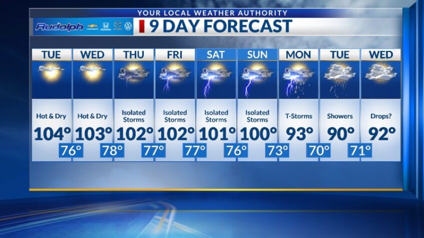
FORECAST: Tuesday will be mostly sunny and dry with a high of 104. Expect partly cloudy skies in the afternoon, and the SE winds will range from 5-15 mph. Wednesday will be mostly sunny with a few afternoon clouds and a high of 103. On Thursday, additional moisture and instability mean a chance of late day, isolated t-storms. Thursday’s high: 102. Friday will be partly cloudy and 102 with isolated late day t-storms. Saturday will be partly cloudy skies with isolated late day t-storms. Saturday’s high: 101. Sunday will be 101 with isolated late day t-storms.
Read: Read More