


You could really feel the difference in humidity today. Dew point temperatures increased to the 50s, and that additional tropical moisture will give us a chance of t-showers tonight. That chance of rain thins out for Wednesday with only a slight chance of showers. Here’s your exclusive 9-Hour Forecast for Wednesday will your 9-Day Forecast below.

TONIGHT: The skies will be partly to mostly cloudy with scattered showers and t-showers in a hit-or-miss pattern. Tropical moisture from Hurricane Priscilla, which is off the west coast of Mexico, is fueling the clouds and showers tonight. Some individual storms may produce brief, heavy rainfall. The low will drop to 67, and the SE winds will range from 5-15 mph.
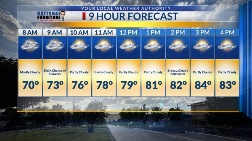
FORECAST: Wednesday will be partly to mostly cloudy and 84 with a slight chance of showers. The elevated humidity will hang around on Wednesday for a humid feel. Thursday will be partly cloudy and warmer with a high of 87. The SE winds will range from 10-25 mph… windy at times. Friday will be partly cloudy and warmer with a high of 90. The SE winds will gust near 25 mph. Another tropical storm will break apart over northwestern Mexico on Saturday. Saturday will be mostly sunny and 92. By late Saturday evening, the skies will turn mostly cloudy with a chance of showers. On Sunday, a tropical moisture surge will increase the cloud cover and rain chances. With a high of 80, expect a chance of scattered, hit-or-miss showers. On Monday, if the long-range data hold together, a significant plume of tropical moisture will pass over the Borderland, and we could experience a heavy rain threat. Monday’s high: 79.

Read: Read More