


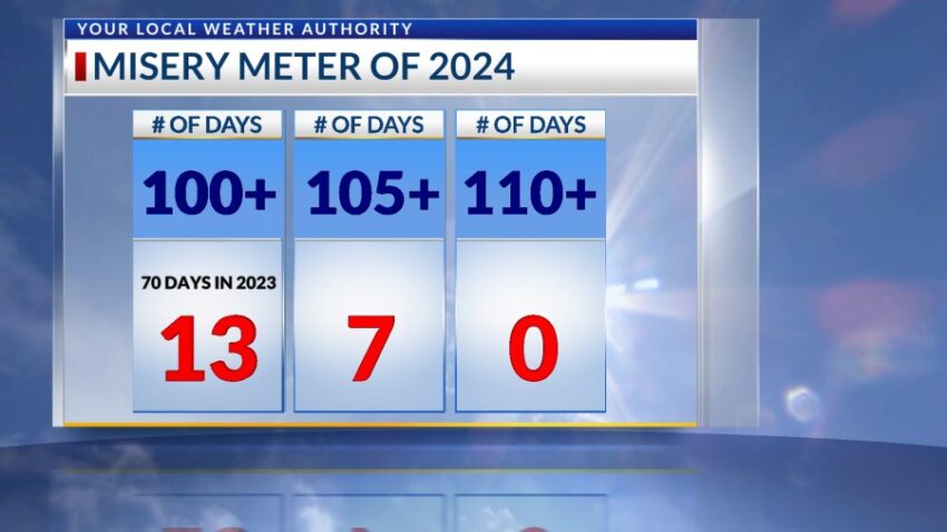
The official high today was 103, making it our 13th triple-digit day so far this year on our exclusive “Misery Meter.” The record on this day was 109 set in 1980. I have some very good news if you’d like a couple days off from the extreme heat. That good news is below…
TONIGHT: The skies will be clear, and the winds will slowly die down. The SW winds will range from 10-35 mph with the strongest gusts on the east slopes of the mountain. Overnight, the winds will turn light, and the low will drop to 74.
FORECAST: Tuesday will be sunny with hot breezes. The SW winds will range from 10-20 mph, not as strong as the winds on Monday. Tuesday’s high: 102. Wednesday will be partly cloudy with scattered late day t-storms. Wednesday’s high: 103. On Thursday, a surge of tropical moisture from the Gulf of Mexico will pass over the Borderland. Thursday will be partly to mostly cloudy and significantly cooler with a high of 87. Expect a few scattered showers as well. Friday will be mostly cloudy to overcast with a high of only 86. A few scattered showers will be possible with the thick cloud cover. On Saturday, the moisture thins out, the sunshine comes back out, and the high pops up to 102.
Read: Read More