


A winter-class storm will affect New Mexico with significant snowfall and a plunge in temperatures. Along the border, we’ll see rain, chilly winds, and big drop in temperatures as well. The official high today is 74, and we’ll drop about 13 degrees for Thursday. Get the big coat ready!
TONIGHT: The skies will be mostly cloudy to overcast and windy at times on the east slopes of the mountains. The NW-W winds will range from 10-25 mph, and the low will drop to 47.
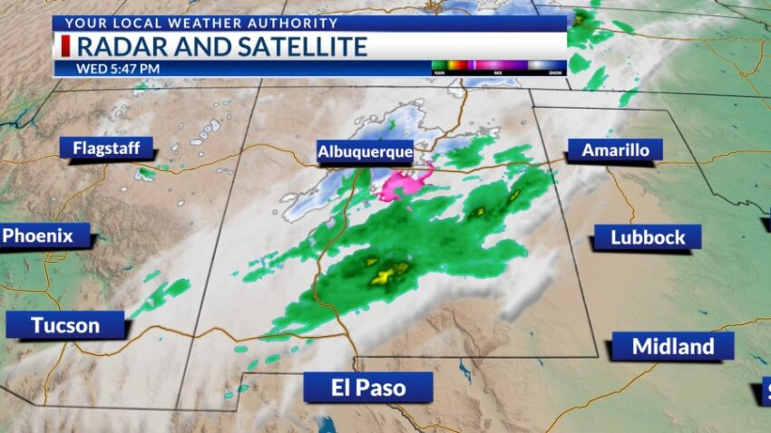
FORECAST: KTSM has issued a Weather Authority Alert due to a significant drop in temperatures as well as a chance of rain showers on Thursday. A low-pressure system will push into Arizona before sweeping through New Mexico. A Winter Storm Warning is posted for the Sacramento Mountains above 7,000 feet, where up to six inches of snow will be possible. In El Paso, the high will be 61 but will feel much colder at times due to gusty, chilly winds. The SW winds will gust to near 25 mph. On Friday, the system quickly moves through New Mexico bringing colder winds. Friday will be partly cloudy to mostly sunny with a high of 58. As the winds die down Friday night, we will wake up to a cold Saturday morning with a low of 32. Saturday will be sunny and 70 with light winds. Sunday will be sunny and 77. Monday will be mostly sunny with warm breezes and a high of 79. Tuesday will bring in some gusty winds, warming us up to 82. A cold front will push through on Wednesday dropping the high to 69.
Read: Read More