


I predicted 62 for today, but we only made it to 60. What a change from yesterday’s 73. The record on this day is 81 set in 1972. KTSM has issued a Weather Authority Alert due to a Cold Weather Advisory that is posted for the east side of El Paso County tonight! Here’s your exclusive 9-Hour Forecast for Thursday.

TONIGHT: A Cold Weather Advisory is posted for the eastern part of El Paso County starting at midnight through 9 AM. The low at the airport will drop to 28, but the E-SE winds will range from 10-20 mph. In the early morning hours, the wind chill will range from 5 to 10 degrees. Act now to protect people, pets, plants, and pipes from this bitter cold night.
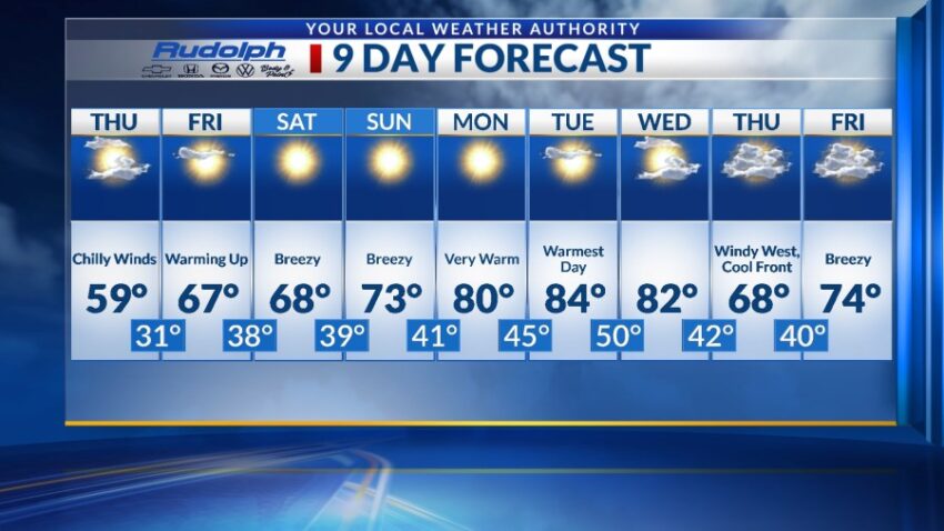
FORECAST: Thursday will be partly cloudy with chilly winds and a high of 59. The E-SE winds will range from 10-25 mph with stronger gusts on the western slopes of the mountains. On Friday, we start to warm up again. Friday will be mostly sunny with warmer breezes and a high of 67. Saturday will be sunny and breezy with a high of 68. Sunday will be sunny and warmer with a high of 73. The SW wind will range from 10-25 mph. Monday will be sunny and 80 as high pressure builds up in a dramatic way. Tuesday will be mostly sunny and 84, our warmest day of the week as high pressure reaches its maximum. Wednesday will be partly cloudy with a high of 82. The winds will become gusty late Wednesday in advance of a cold front on Thursday.

Read: Read More